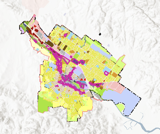
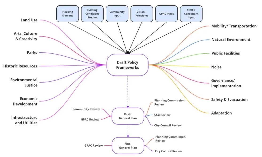
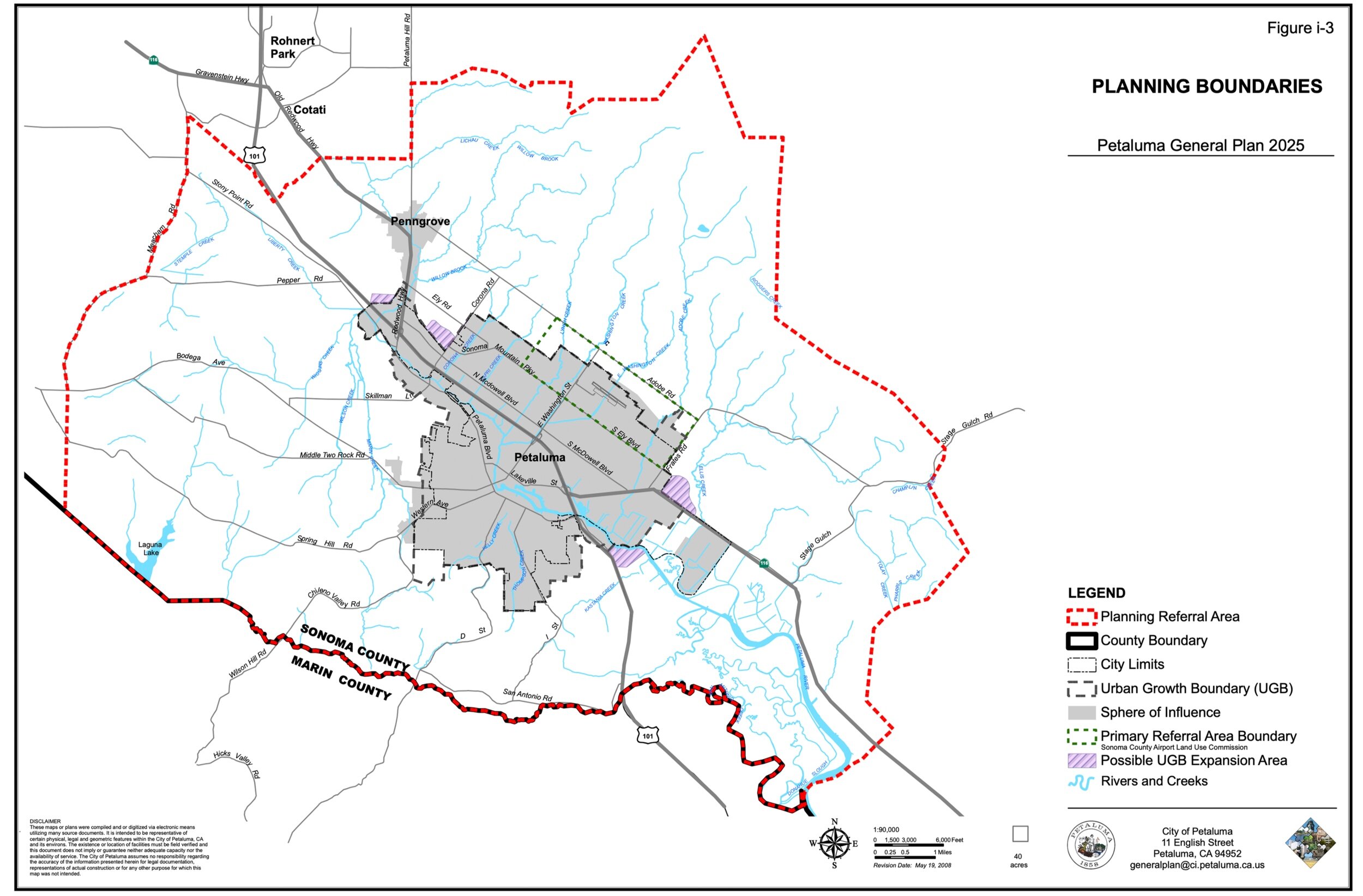
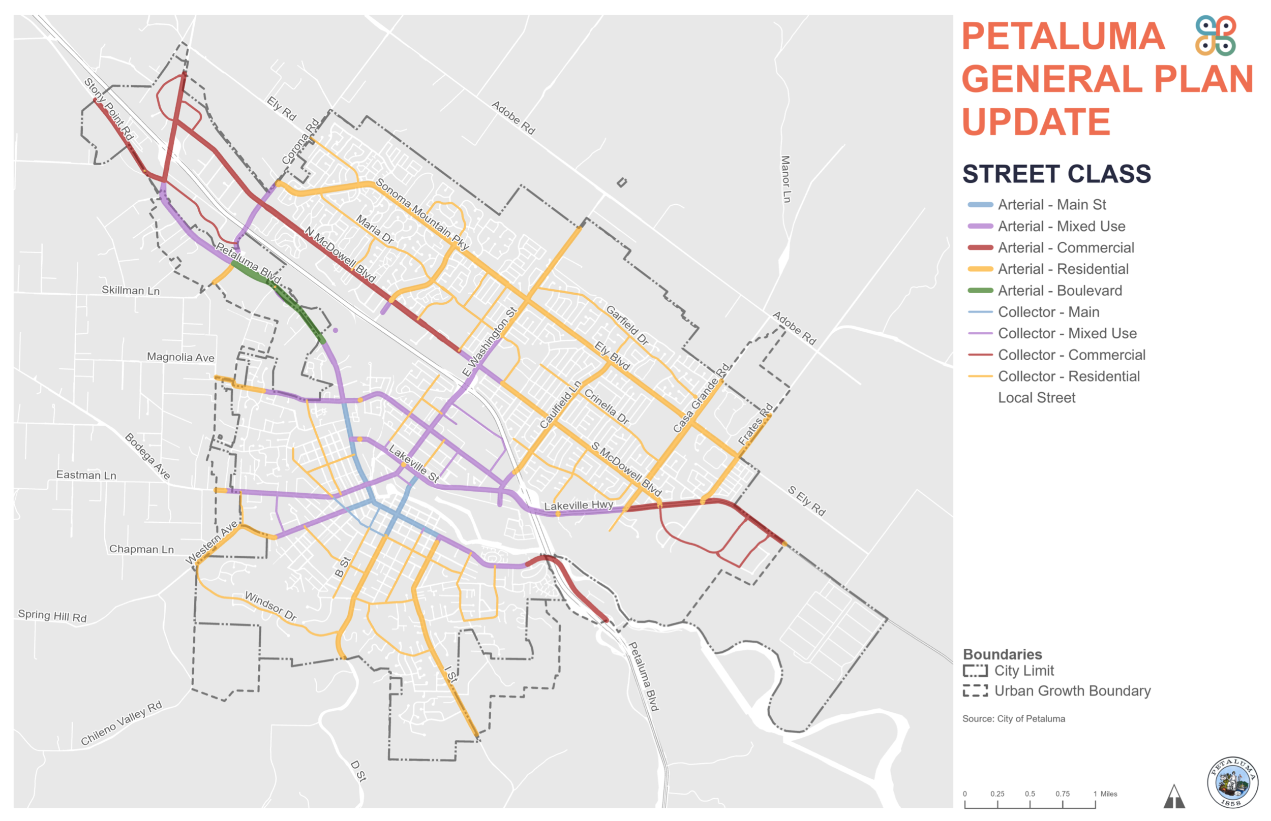
On December 15, 2025, Petaluma City Council selected a land use map and took a major step forward in updating the City’s General Plan, last updated in 2008. The land use map is a major component of the General Plan Update.
The approved map will continue to be analyzed as part of the General Plan Update that includes an Environmental Impact Report, which will help the community and decision makers understand the potential environmental impacts of the updated General Plan.
Click here to view the interactive and searchable Land Use Map. Please note that this page may take a moment or two to fully load.
To view the map layers and information click on the icons on the far left of the screen or enter an address or APN in the search bar.
Use the checkbox next to the layer to turn it on or off. To view multiple layers at once, click on the three dots next to the layer name and click on transparency to adjust the visibility of layers.
Click here for a short video tutorial on how to use the interactive map.
The draft map was presented to the GPAC at a meeting on November 13, 2025 and the Planning Commission at a Special Meeting on November 20, 2025. City Council approved a resolution directing staff to move forward with the draft map on December 15, 2025.
It is anticipated that the draft General Plan and the draft EIR will be ready for public review in Spring of 2026. For questions or assistance with the preferred Citywide Land Use Map, please email planpetaluma@cityofpetaluma.org.
In addition to the preferred Citywide Land Use Map, the City will be updating the Land Use Standards that regulate the density and intensity of use on a parcel.